Landscape recovery following wildfire
For my B.A. at Wesleyan University I had the opportunity to work on a Keck Consortium research project in the Colorado Front Range. In summer 2012, following geology field camp school in Wyoming, Idaho, and Montana, I moved into a cabin at Colorado University’s Mountain Research Station to begin four weeks studying the impact of a 2010 wildfire in Fourmile Canyon outside Boulder, Colorado. I studied the relaxation time of extreme erosion events brought on by moderate rainfall following the fire, and also the influence of historical mine tailings piles on the geochemistry of the sediment. Here’s my thesis.
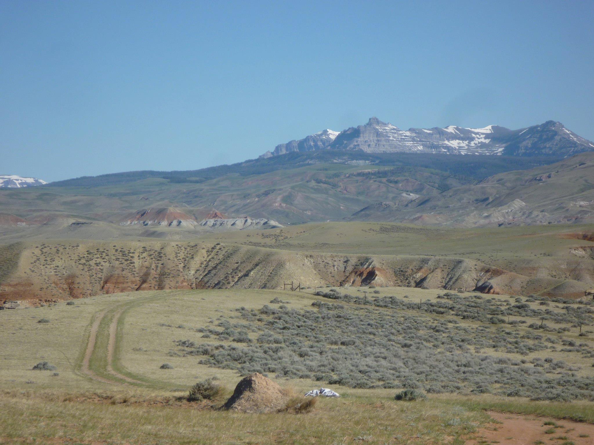
A typical Wyoming view during field school.
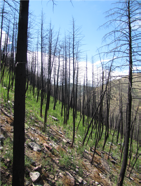
Return of grasses and shrubs among severely burned trees in Fourmile Canyon.
Measuring topography from space
Validation of DEMs
In this work for my masters I validated the elevation accuracy and geomorphic potential of near-global spaceborne Digital Elevation Models (DEMs), including SRTM-C, TanDEM-X, ALOS World 3D, and ASTER GDEM2. I also worked on photogrammetric DEM production with raw optical scenes like ASTER L1A, RapidEye, SPOT6, and ALOS PRISM, as well as interferometric DEM production from TerraSAR-X/TanDEM-X CoSSC scenes. Validation was carried out with a huge dataset of differential GNSS measurements collected over three field seasons in northwestern Argentina. Here’s the publication in Earth Surface Dynamics that came out of it. More recently, we also improved on validation using sparse benchmark data through Fourier analysis in the frequency domain to examine the inter-pixel consistency of spaceborne DEMs. You can read about that in Frontiers.
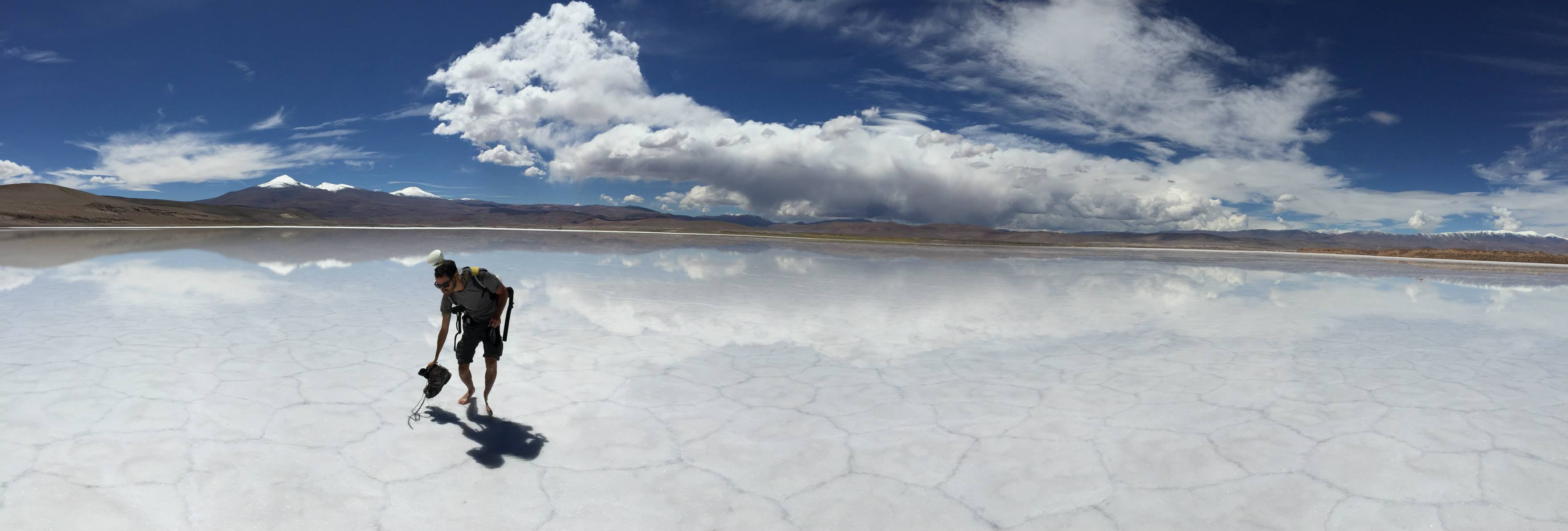
Collecting differential GPS measurements from a salar following a rare rain event on the arid and remote Puna Plateau in Argentina.
Measuring decadal land-level changes using DEMs
Akin to studies of DEM differencing for measuring snow and ice change, I applied careful correction and differencing to the TanDEM-X (collected 2011-2015) and SRTM-C (collected 2000) DEMs to measure ~15 years of land-level changes in some large catchments draining the eastern flank of the Andes in northwestern Argentina. Due to the small magnitude of most land-level changes, the 15-year separation between the DEMs only allowed for sparse automated geophysical results. These vertical change signals were defined outside of remaining vertical uncertainty, primarily caused by the lower quality SRTM-C DEM, despite careful bias correction procedures developed. We were able to gain insight into riverbed aggradation and incision in the Río Toro and Río Grande, particulalry in downstream sections, which are steeper (due to knickpoints), wetter, and modified by anthropogenic activity. Here’s the publication in Earth Surface Dynamics that came out of it.
Lower Río Toro shot on a DJI Mavic Pro drone. Note the big gravel piles being formed to prevent rapid channel-bed aggradation.
River surveys, pebble counting, and downstream changes in sediment character from SAR
Moving from the scale of entire catchments using meter-scale spaceborne DEMs, I collected 1,000-5,000 m2 river-bed surveys at sub-cm scales. The surveys, amounting to over 50,000 photos, were collected using a camera-on-mast setup (see the videos below). We also flew some drone surveys to supplement these data. Point clouds, micro-DEMs, and orthomosaics were generated by structure-from-motion and multi-view stereo (SfM-MVS) processing. Following dissatisfying results from existing tools, our intention to count the grain-size distributions was realized in our Python-based software PebbleCounts, with the accompanying paper in Earth Surface Dynamics.
Recently, we applied PebbleCounts to examine downstream fining in the Quebrada del Toro in northwestern Argentina, and we found some interesting variability at the coarse tail of the distribution. Read about that in JGR.
We also explored the use of spaceborne Synthetic Aperature Radar (SAR) measurements of surface roughness from channel beds using satellites like TerraSAR-X, Sentinel-1, and ALOS PALSAR. These SAR data can be used mainly for discerning gravel and sand transitions over huge areas, but it is hard to look at absolute grain sizes in the channel…see the publication in Remote Sensing of Environment.
Surveying in the upper Quebrada del Toro Catchment in calm conditions.
Surveying in the upper Quebrada del Toro Catchment in high winds on a Quaternary fluvial terrace.